Skip to main content
Vreugdestappers
Wandelclub Vreugdestappers
Menu
De Vreugdestappers
Historiek
Het bestuur
Lid worden
Onze sponsors
Onze wandelingen
Pannekoekentocht Neerijse
Herfstwandelingen Bertem
Voorjaarswandelingen Tervuren-Moorsel 2026
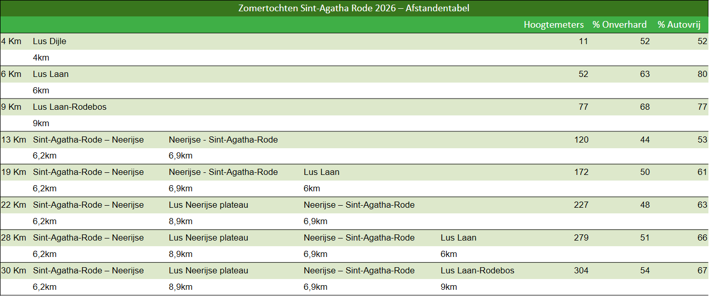
Zomertochten Sint-Agatha-Rode
Zomerwandeling Sint-Agatha-Rode 2026 – kaarten
Voor clubleden
Welkom
Vrijdagwandelingen
Vijfdaagse Vught
Vreugdeklapper
Onze vreugdemomenten
Betaling lidmaatschap
Onze Clubwinkel
Contact
Disclaimer
Websiteproblemen
Zomerwandeling Sint-Agatha-Rode 2026 – kaarten
Zomerwandeling Sint-Agatha-Rode 2026 – kaarten
4km
19km
6km
22km
9km
28km
13km
30km
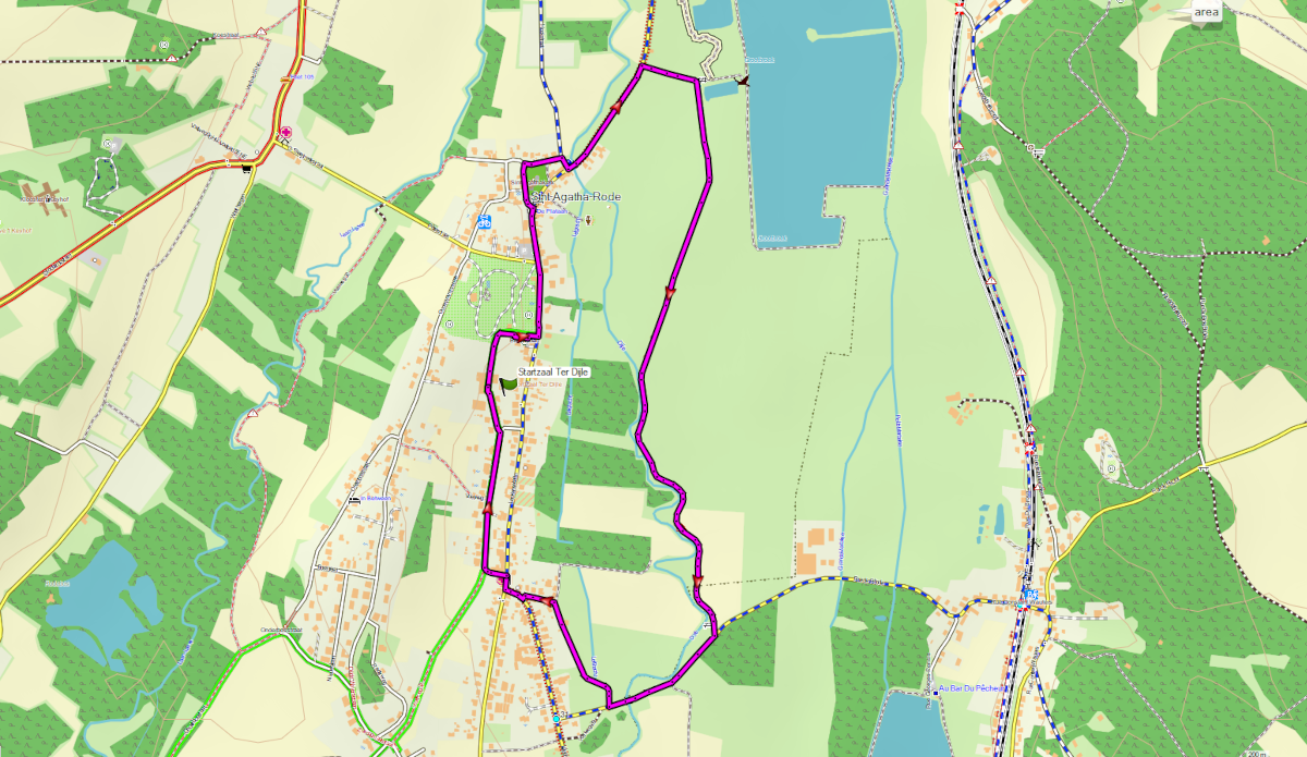
Wandeling van 4km: Sint-Agatha-Rode – lus Dijle
GPX
–
Google Maps
☝
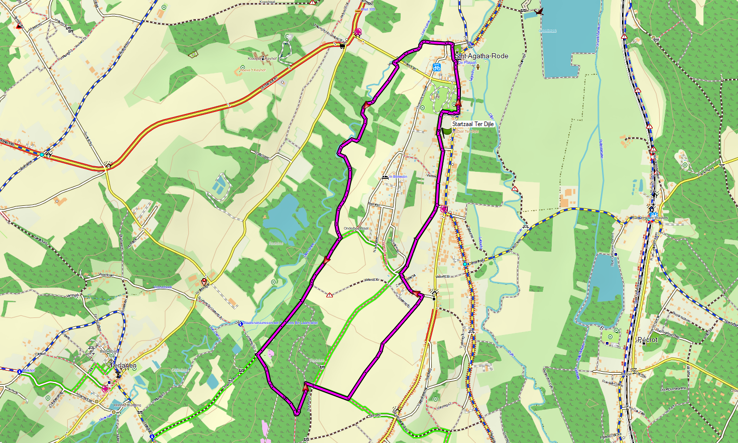
Wandeling van 6km: Sint-Agatha-Rode – lus Laan
GPX
–
Google maps
☝
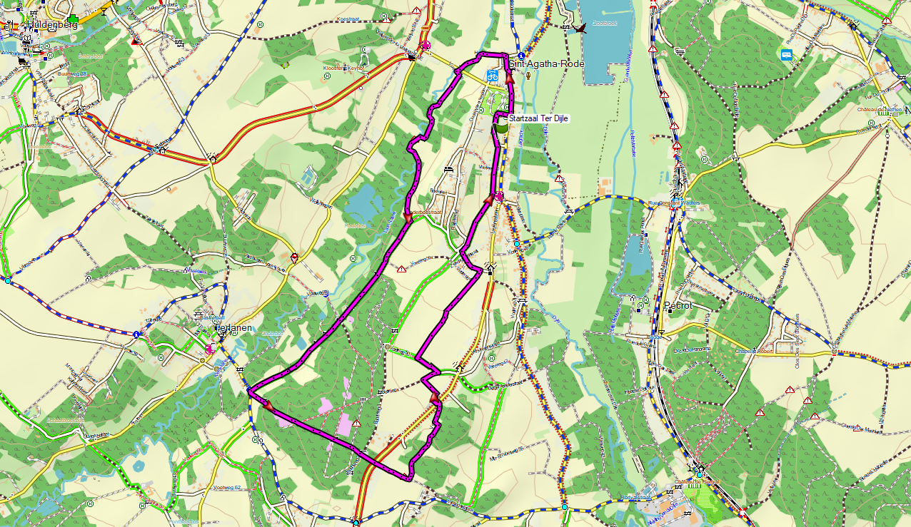
Wandeling van 9km: Sint-Agatha-Rode – lus Laan-Rodebos
GPX
–
Google maps
☝
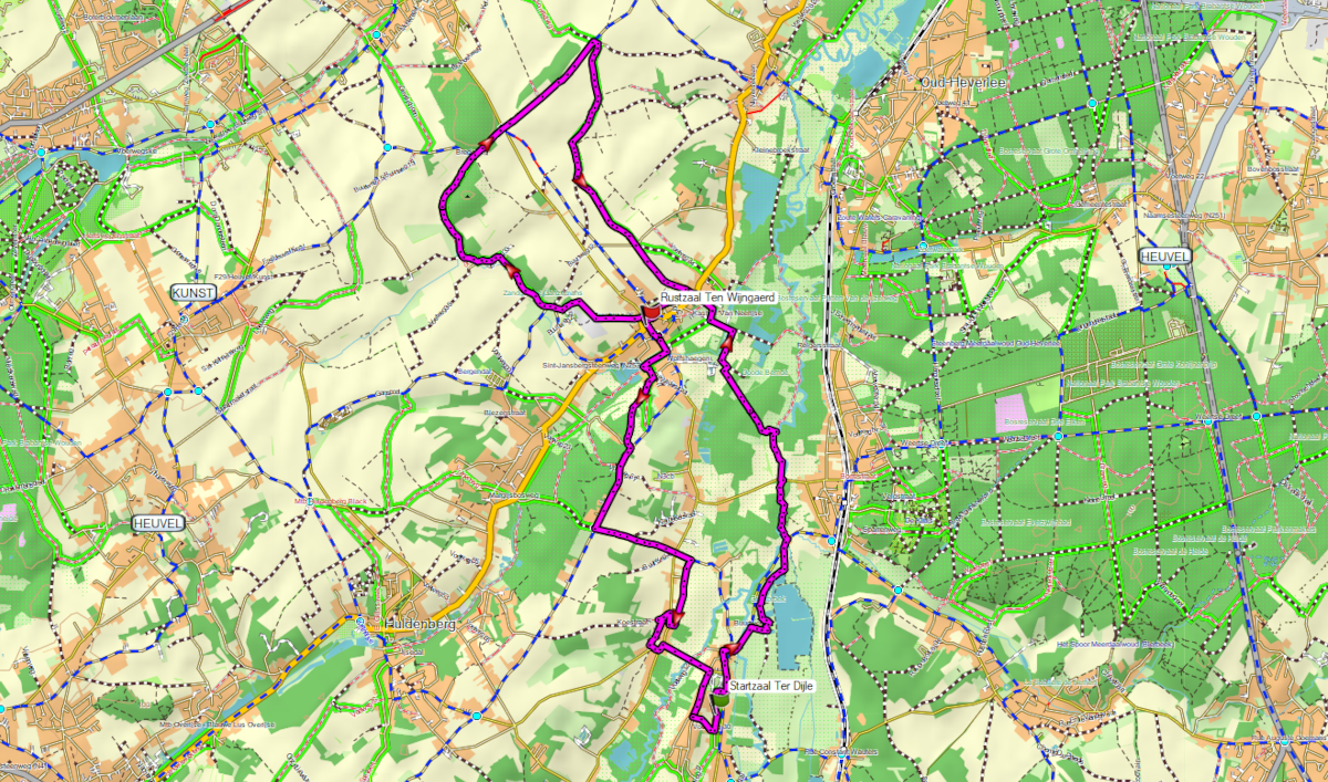
Wandeling van 13km: Sint-Agatha-Rode – Neerijse + Neerijse – Sint-Agatha-Rode
GPX
–
Google maps
☝
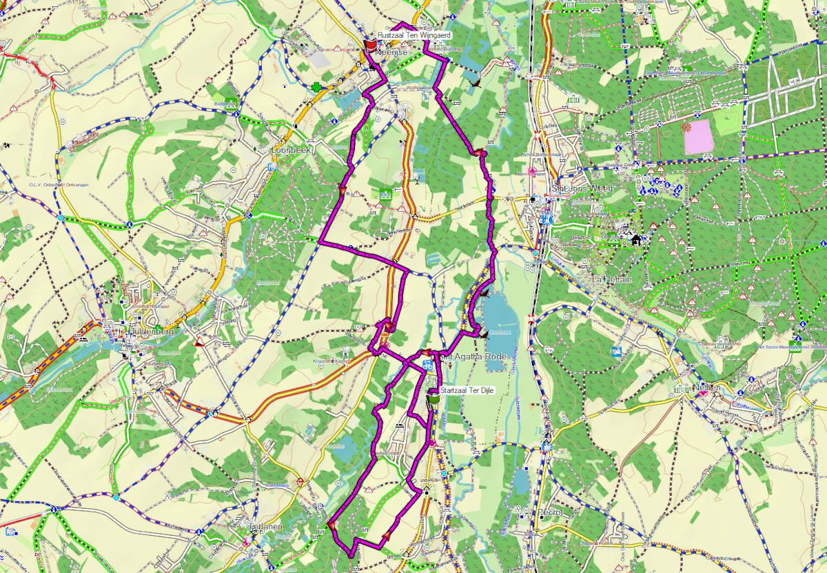
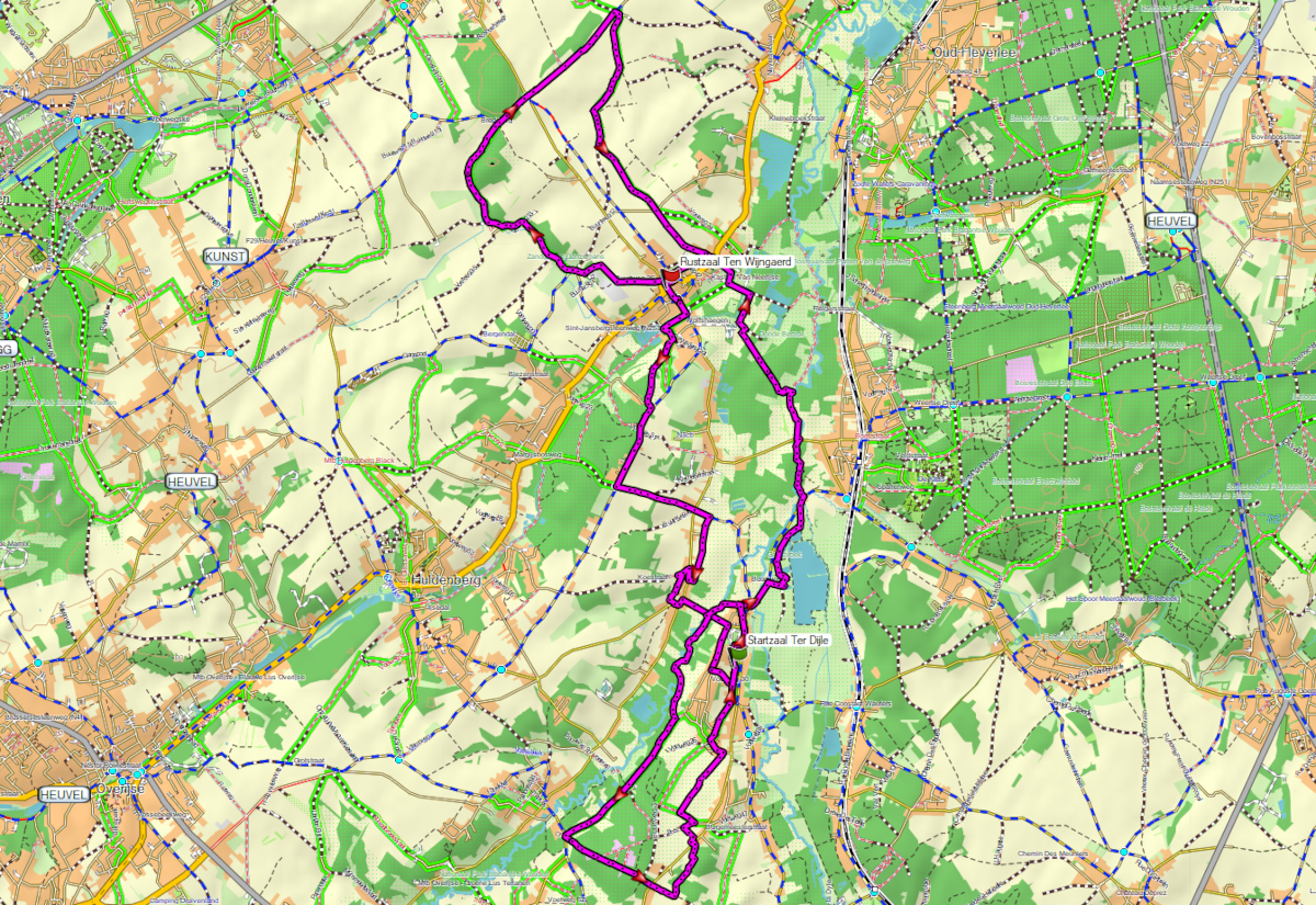
Wandeling van 19km: Sint-Agatha-Rode – Neerijse + Neerijse – Sint-Agatha-Rode + lus Laan
GPX
–
Google maps
☝
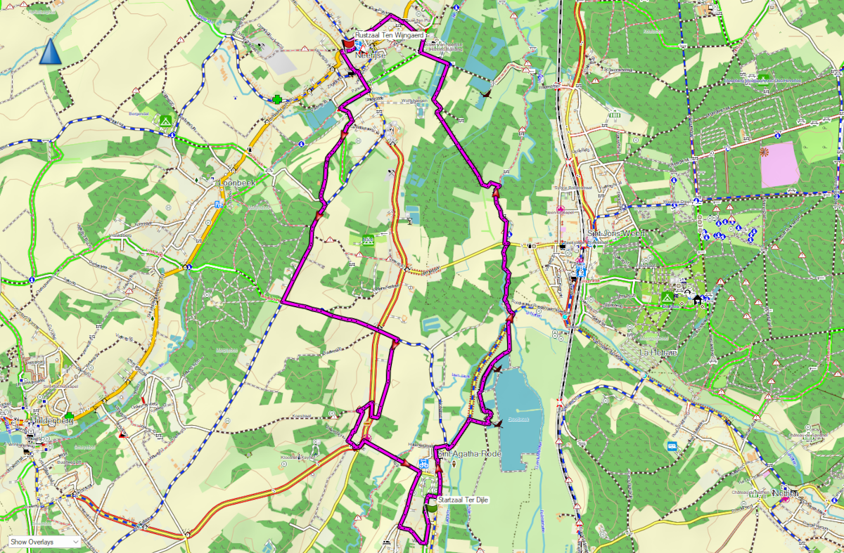
Wandeling van 22km: Sint-Agatha-Rode – Neerijse + Lus Neerijse plateau + Neerijse – Sint-Agatha-Rode
GPX
–
Google maps
☝
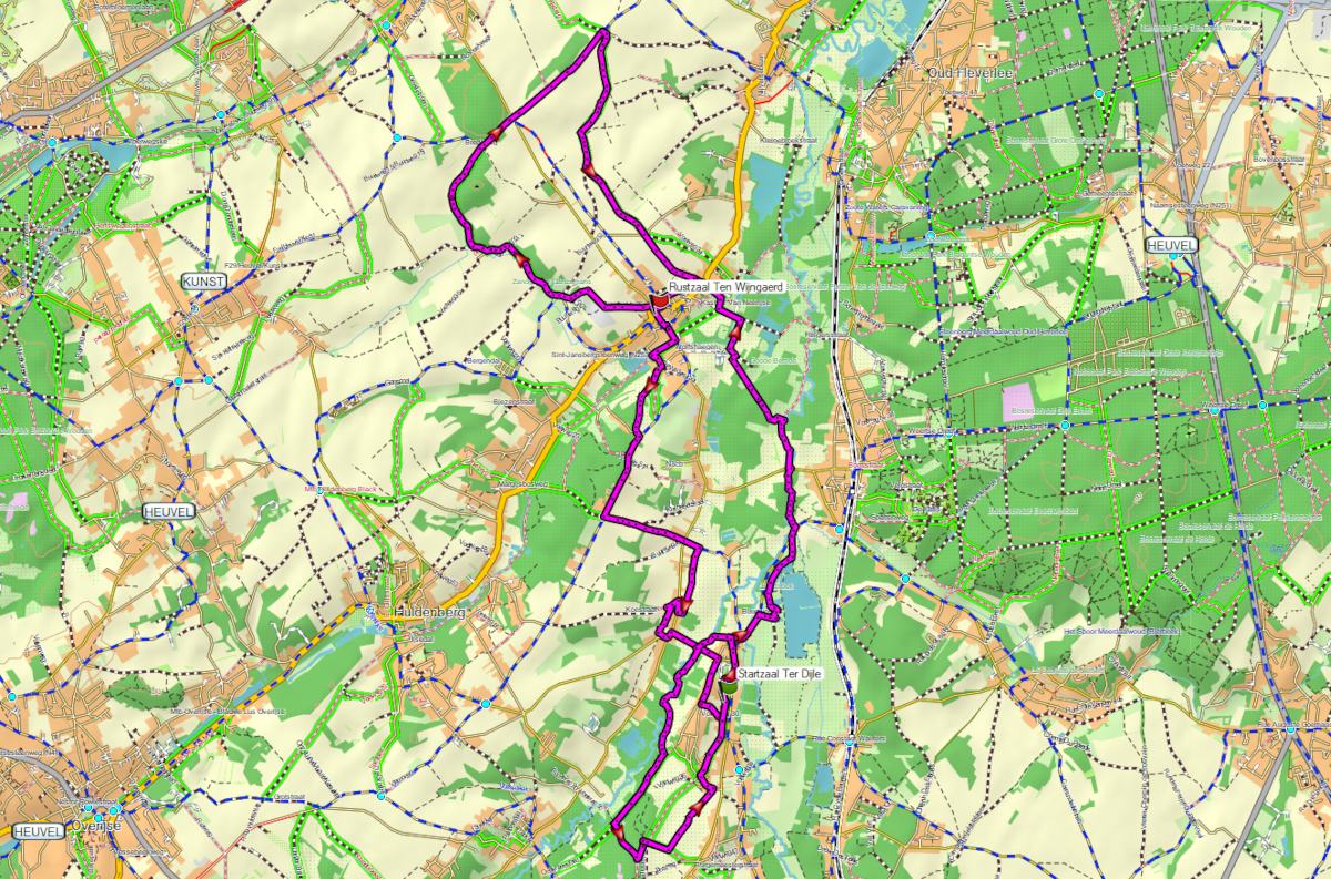
Wandeling van 28km: Sint-Agatha-Rode – Neerijse + Lus Neerijse plateau + Neerijse – Sint-Agatha-Rode + lus Laan
GPX
–
Google maps
☝
Wandeling van 30km: Sint-Agatha-Rode – Neerijse + Lus Neerijse plateau + Neerijse – Sint-Agatha-Rode + lus Laan-Rodebos
GPX
–
Google maps
☝